12 Best Photo Spots on the Ha Giang Loop (With Map Pins and 15+ Photography Tips)

So, you’ve heard the rumors: the Ha Giang Loop is home to some of the most jaw-dropping mountain scenery in Southeast Asia.
But here’s the thing—not all viewpoints are created equal. Some are “meh,” while others will straight-up make your Instagram followers scream, “WHERE IS THIS AND WHY AM I NOT THERE?!”
That’s why, in this guide, we’re spilling the secret sauce: the best photo spots on the Ha Giang Loop with exact map pins, drone tips, and all the know-how you need to shoot like a pro (or at least look like one).
Why is Ha Giang so Popular with Photographers?
Ha Giang province, in Vietnam’s far north, is home to jagged karst formations, terraced fields that undulate like emerald waves, and ethnic-minority markets bursting with color.
Unlike more crowded routes, the Ha Giang Loop still feels raw and undiscovered—perfect for photos that stand out in an Instagram feed.
Untouched Landscapes: Far fewer tour buses than Sapa, allows for the perfect crowd-free drone shots.
Cultural Depth: Hmong, Tay, Dao, and other communities draped in traditional clothing.
Epic Views: Mountain passes, skywalks, and river canyons you won’t find anywhere else.
 Nho Que River on the Ha Giang Loop
Different Seasons and Changing Weather in Ha Giang
It’s important to note that Ha Giang’s skies can flip on you. Stay nimble:
Forecast Ritual: Check in with Bong Hostel or local sites for hourly updates.
Raincoat for You & Gear: High‑quality, breathable shell + dry sacks for cameras.
Light Management: Midday sun can scorch details—opt for shaded vignettes or return at dusk.
Seasons Matter:
Spring: Yellow mustard blooms—shoot wide to include fields + sharp mountain lines.
Autumn: Deep greens, buckwheat petals—snap closeups of flowers with macro mode, then step back for landscape context.
Now strap on that DSLR, charge your drone batteries, and let’s hit the map!
Related article: Rainy Season on the Ha Giang Loop: Tips, Safety, & What to Expect.
Top 12 Photo Spots on the Ha Giang Loop
Below are our ten can’t-miss locations—complete with Google Map links and the scoop on when (and how) to shoot them.
1. Quan Ba “Heaven’s Gate” or Twin Mountains (or Fairy Bosom)
Map Pin: Quan Ba Heaven Gate
Best Time: Late afternoon when the low sun backlights the karst towers
Drone-friendly: Yes
Drone Tip: Clear fields below—fly above the cloud layer for ethereal aerials
High on a ridge, Heaven’s Gate offers panoramic views over the “Twin Mountains” (Núi Đôi) and Tam Sơn Valley.
And yes, you read that right. These perfectly rounded, side-by-side hills are nature’s cheeky masterpiece. Locals call them "Co Tien" (Fairy Breasts).
Park up, then either hike a few minutes to the overlook or launch your drone straight out into the low afternoon sunshine.
Photo Tip: Use a wide-angle lens to exaggerate the curvaceous landscape. Add a friend in the foreground for scale (and laughs).
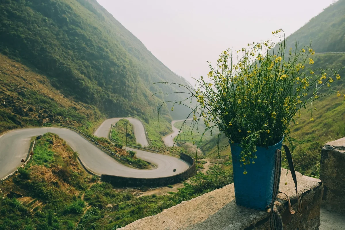
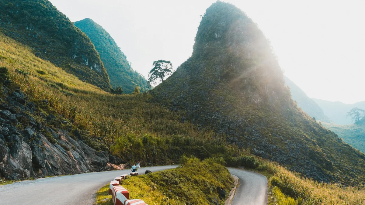
2. Tham Ma Pass Hairpin Turns
Map Pin: Coffee Tham Ma
Best Time: Mid-morning, when traffic is light and the light is soft
Drone-friendly: Yes
Drone Tip: Altitude above 100 m for full spiral; watch for thermals near cliffs
The Loop’s signature zig-zag road carved into limestone cliffs: Tham Ma Pass.
Park at the curve’s edge, climb to the viewpoint, and send your drone for a top-down spiral shot that captures the full swoop of the bend.
If you prefer phone photography, stand at the highest point (this is on the left hand side of the viewpoint where the children braid people’s hair) and use a wide-angle lens to exaggerate the road’s ribbon effect.
Related article: The Best Mountain Passes on the Ha Giang Loop: Plus Two Secret Ones You Need to Visit.
 Tham Ma Pass Viewpoint
3. Lung Cu Flag Tower
Map Pin: Lung Cu Flag Point
Best Time: Early afternoon for sweeping blue skies
Drone-friendly: Yes
Drone caution: Border zone—fly low and don’t go near the Chinese side
Perched just 2 km from the China border, Lung Cu’s 30 m flagpole marks Vietnam’s northernmost point.
The climb up is worth it: from the top, you can frame the tower against rolling hills and, if your drone’s GPS is solid, map out the horizon line for a perfectly centered composition.
Top Tip: Be discreet with your drone here—this area is sensitive. Keep your flight path east to avoid restricted zones.
4. Ma Pi Leng Skywalk & River Gorge
Map Pin: Ma Pi Leng Pass | Ma Pi Leng Skywalk
Best Time: Sunrise or just after dawn, before the crowds
Drone-friendly: Yes
Drone Tip: Watch the wind—the path hugs a 1,600 m drop!
So here I’m talking about two different locations: The Ma Pi Leng Skypath, which allows you to walk out onto that viral cliff edge and the Ma Pi Leng Pass.
The Skywalk involves a small trek along a narrow path and the pass is a winding road, which overlooks the Nho Que River—think Grand Canyon vibes with way more motorbikes and way less safety railings.
Drone pilots, launch from the pull-out above and descend slowly to reveal the emerald water snaking below jagged walls—legendary stuff for your portfolio.
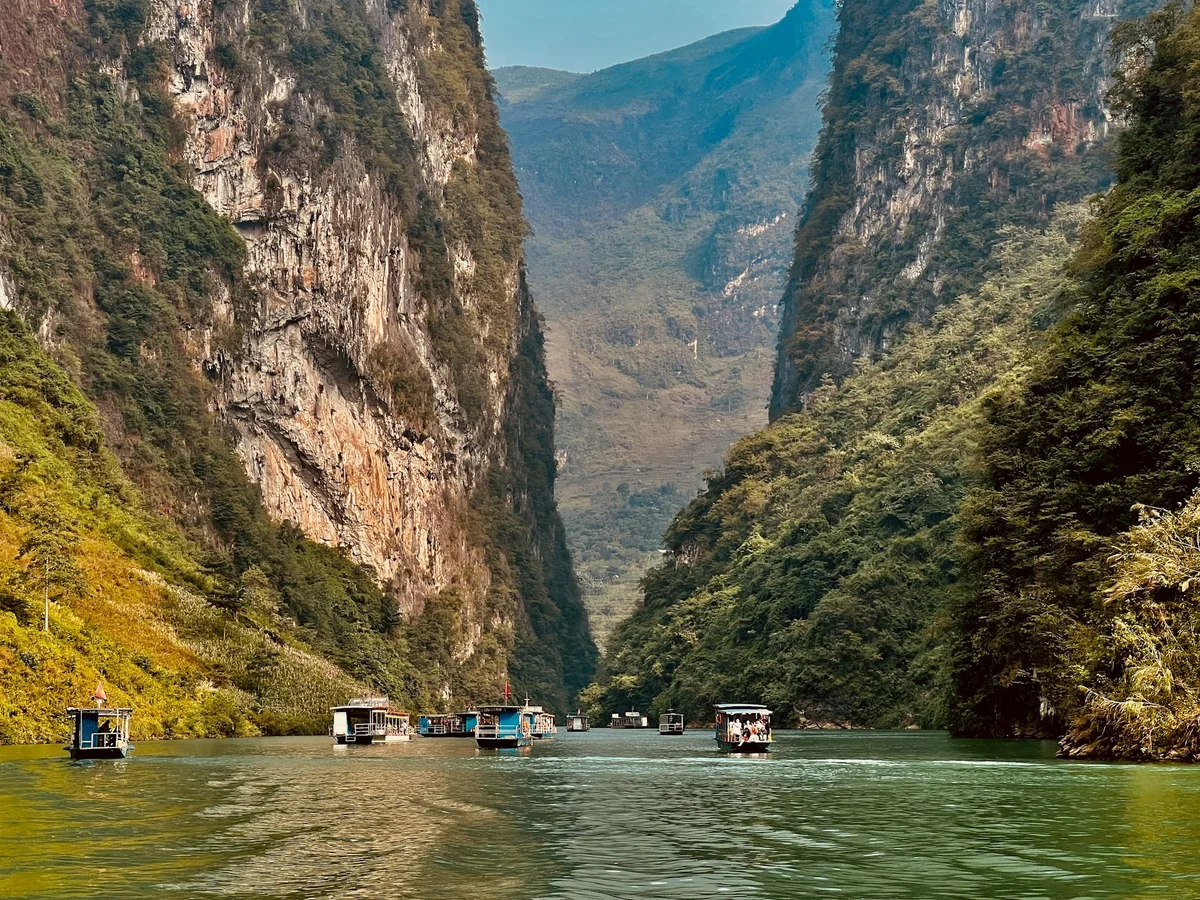
5. Nho Que River Boat Ride
Map Pin: Song Nho Que
Best Time: Early morning calm; evening golden reflections
Drone-friendly: Yes
Drone Tip: Fly with care—keep at least 50 m away from boat traffic
Speaking of the Nho Que River, let’s hop on a small boat and drift through Tu San Canyon.
From the riverbank, capture the canyon walls converging overhead.
From the boat, hold your camera steady on the bow for leading-line shots.
If your drone can stay aloft in the narrow space, aim for a dynamic shot of the boat cutting through turquoise water framed by towering cliffs.
6. Buckwheat Flower Fields (October–November)
Map Pin: Lung Cam Cultural Village
Best Time to Shoot: Late afternoon when the sun hits those pastel petals just right
Drone-friendly: Yes
Drone Friendly? Technically yes, but keep your altitude low—no crop dusting the flowers, please.
In October and November pastel pink, white, and purple Buckwheat Flowers blanket the rolling hills. These seasonal blooms aren’t just pretty however, they’re culturally meaningful to the local Hmong people.
Photo Tip: Shoot from low angles for dreamy foreground blur. Add a local in traditional dress and boom—postcard vibes.
Related article: Understanding the Different Ethnic Groups on the Ha Giang Loop.
 The Buckwheat Flower Festival is celebrated in October and November each year
7. Du Gia Village & Waterfall
Map Pin: Du Gia Village
Best Time: Mid-afternoon for waterfall sparkle; morning for village life
Drone-friendly: Yes
Drone Tip: Capture the waterfall from above, then pan down to the pool
Du Gia is a laid-back hamlet nestled among rice paddies. Snap the stilt houses and tiny temples at dawn, then hop a short hike to the waterfall.
Use a slow shutter (1/4 – 1 s) on a tripod for that dreamy, milky water effect.
Drone lovers can capture the cascade from overhead—just be mindful of low tree cover.
Psst! During harvest season, the terraces glow in gold. Sunrise captures the mist and light rays rising over the mountains.
Related article: Top 10+ Waterfalls in North Vietnam to Visit in 2025 (With Swimming & Trekking Tips).
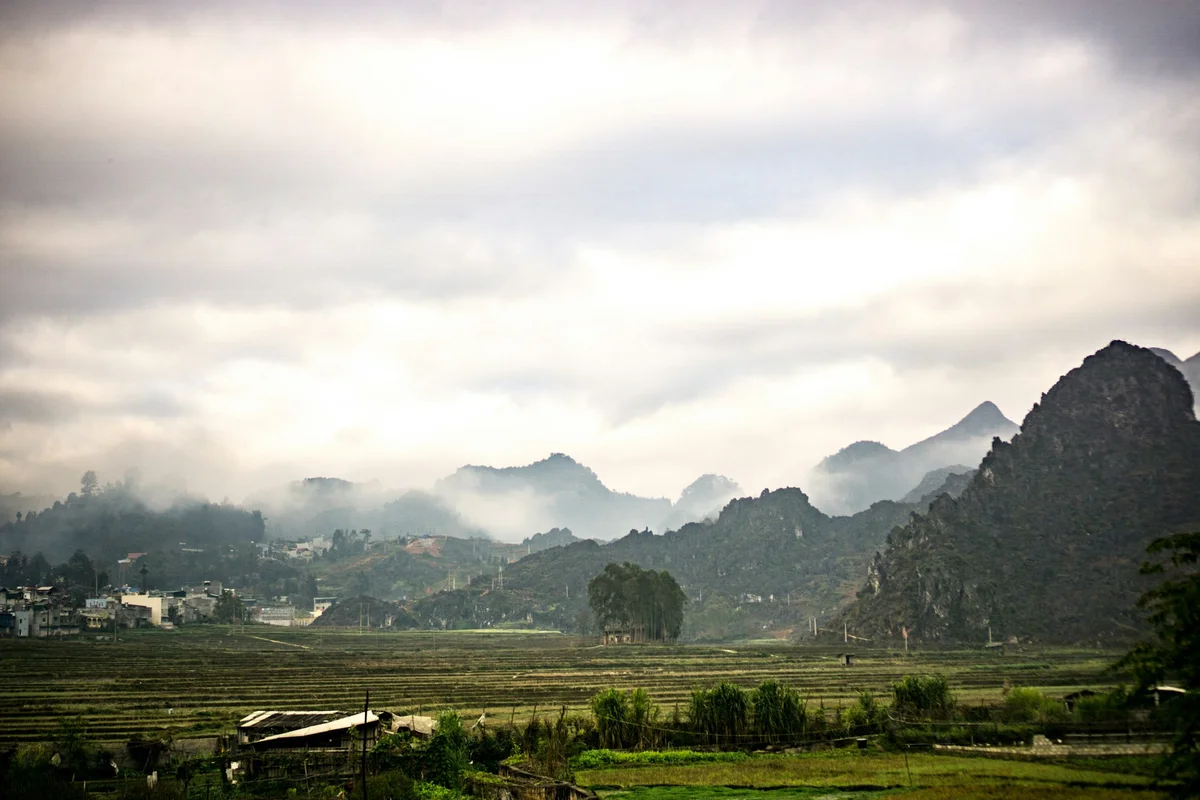
8. Dong Van Karst Plateau Geopark
Map Pin: Dong Van Viewpoint
Best Time to Shoot: Golden hour (5–6:30 PM)
Drone Friendly? Yes
Drone Tip: Be careful of the strong gusts
This UNESCO-listed wonderland is a geological rockstar—home to ancient limestone formations, deep valleys, and tiny ethnic villages that look like they popped out of a Studio Ghibli movie.
Photo Tip: Use natural frames like archways or trees to spotlight locals in traditional attire against the craggy backdrop.
Related article: Discover 9 Must-Visit Local Ethnic Villages on the Ha Giang Loop (Plus 1 Secret Village with Bong Hostel).
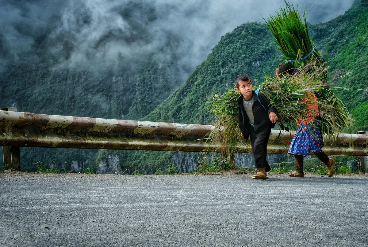
9. Local Markets & Villages
Map Pin: Dong Van Old Quarter | Meo Vac Weekly Market
Best Time: Early morning hustle (before 9 AM)
Drone Friendly? Nope. Keep it grounded and respectful.
Every Sunday, Dong Van’s Old Quarter and Meo Vac Square transform into bustling market places.
Prepare for locals selling spices, bartering pigs, or just sipping tea in traditional shawls, which create endless portrait opportunities.
On the street level, use a fast lens (f/1.8) for shallow depth-of-field portraits.
If you must operate your drone, do so from nearby rooftops or open fields, drones can capture the full market mosaic—just watch for power lines.
Photo Tip: Shoot from eye-level or lower for intimate, storytelling angles. Always ask before photographing people—a smile and “OK chup hinh?” go a long way.
10. Nam Dan Karst Forest & Hmong Portraits
Map Pin: Located in Quan Ba
Best Time: Late morning for dappled light through the trees
Drone Friendly? Not recommended—keep it low, focus on portraits
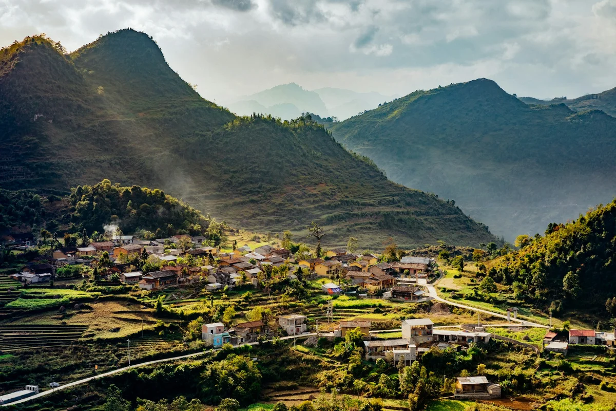
In Quan Ba district, Nam Dan’s limestone spires loom over a tiny Hmong village.
This spot is perfect for portraiture and documentary photography: ask polite permission, then frame your subject against the rugged “rock forest.”
Use a reflector or fill flash for balanced lighting.
11. Pho Bang Rice Terrace & Village
Map Pin: Pho Bang
Best Time: August–September during planting; soft dawn light
Drone Friendly? Yes
Drone Tip: Sweep from village section to terrace for context
Pho Bang’s fields curve in concentric rows that hug the hillside. At sunrise, a gentle backlight will accentuate the contours.
For ground shots, find a high ridge for wide panoramas.
Drone pilots can create cinematic reveals—start focused on the village, then ascend and pan to show the vast terraces.
Bonus Spot: Hoang Su Phi Rice Terraces
Map Pin: Hoang Su Phi Rice Terraces
Best Time: Early October during harvest; sunset for golden highlights
Drone-friendly: Yes
Drone Tip: Scouted “waves” pattern from 120 m altitude for maximum effect
The rice terraces here ripple across mountainsides like emerald waves. Plan two days: explore Ban Phung, San Xa Ho, and Thon Chu Phin.
For ground shots, use a telephoto lens to compress layers.
For birds-eye views, send your drone over the ridges just as the sun dips behind the peaks, and let the shadows accentuate the curves.
Top Tip: Book your Ha Giang Loop tour with Bong Hostel to hit most of these spots stress-free. Our guides know the roads, the light, and the secret turn-offs that get you that shot.
 Ma Pi Leng Skywalk
Photo Tips to Capture Ha Giang at Golden Hour
When: Roughly 6–8 AM and 5–7 PM, depending on season and elevation.
Why: The sun sits low, bathing mountains in warm, diffused glow that flatters everything—rice terraces sparkle, limestone karsts pop, and skin tones turn buttery.
1. Scout Early, Shoot Early
Arrive at least 20 minutes before sunrise/sunset to set up.
Watch the light change: sometimes the best colors happen 10 minutes before the sun ever appears.
2. Vary Your Angles
Low angles (think: bike handlebars in foreground) dramatize roads and terraces.
Tilted frames introduce dynamism—lean into curves and let the mist swirl around the edges of your shot.
3. Polarizer Power
A CPL filter kills glare on wet leaves and water, deepens skies, and makes colors “pop” without oversaturation.
Twist it until reflections vanish, then watch your landscape transform.
4. Balance Light & Shadow
Use spot meter or exposure compensation to avoid blown highlights on clouds or underexposed valleys.
For portraits of Hmong women in traditional dress, let the warm backlight rim their silhouette and use a reflector (or phone screen!) to fill in faces.
Ha Giang Village & Market Portraiture: Photography Tips
Ha Giang’s soul lives in its people, villages, and markets. To respect and convey that:
5. Permission & Rapport
Always ask: “Chụp ảnh được không?” (May I photograph you?)
A friendly smile and a shared loop‑travel anecdote unlock genuine expressions.
6. Shoot Their World
Document daily rituals—rice pounding at dawn, weaving workshops, steaming pho stalls.
Use a 50 mm or 85 mm lens for flattering environmental portraits with gentle background blur.
7. Timing & Light
Early morning: soft side‑light on faces, market stalls coming to life.
Late afternoon: golden backlight through colorful shawls and produce piles.
8. Cultural Context
Learn local customs—e.g., Hmong women’s indigo patterns—and highlight them.
Frame subjects against authentic backdrops: stilt‑house doorways, wooden looms, or woven baskets.
9. Composition Hacks for Next-Level Shots
Rule of Thirds: Place horizons and subjects along grid lines for balanced framing.
Leading Lines: Let roads, rivers, and terraces draw the eye inward.
Frame Within a Frame: Use doorways, archways, or foliage to create natural borders.
Scale & Perspective: Include a motorbike or person to show epic proportions.
Negative Space: Let misty skies or open fields breathe around your subject.
Symmetry & Patterns: Rice terraces and zig-zag roads are nature’s own mandalas—center them for impact.
How to Edit Your Ha Giang Loop Photos: Top Tips
Your RAW files are gold—process them carefully:
10. Software
Adobe Lightroom (desktop + mobile), Snapseed for quick fixes.
11. Color & Contrast
Boost mid‑tone contrast to add “pop” without crushing shadows.
Tweak white balance to retain that warm golden‑hour hue.
12. Crops & Composition
Re‑frame to obey rule of thirds or center symmetry for terraces and passes.
Straighten horizons—skewed mountain tops look, well, wobbly.
13. Sharpen & Clarity
Apply selective sharpening to ridges and ridgelines.
Use Dehaze sparingly on misty scenes—don’t turn fog into smog.
14. Finishing Touches
Subtle vignettes to focus attention.
Spot‑heal distracting litter, stray wires, or wayward tourists.
Drone Dos & Don’ts in Ha Giang
✅ DO:
Do keep your drone at least 50 m from people, vehicles, and structures.
Do fly early when thermals are calmer.
Do keep it under 120 meters.
Do respect local requests—if someone says “no photos,” listen.
❌ DON'T:
Don’t venture near border posts, military zones, or densely populated villages.
Don’t rely solely on GPS—bring a visual reference.
Don’t disturb animals.
Don’t forget to land somewhere safe if the wind kicks up unexpectedly.
Additional tips:
Register if staying long-term: If you're a resident or staying long-term, Vietnam’s Ministry of Defense technically requires drone registration, but short-term travelers aren’t usually checked.
Use Return-to-Home (RTH) with caution: Mountain GPS can be glitchy—make sure your RTH height is set high enough to avoid cliffs.
Battery drains faster in altitude: Carry extra batteries if you're serious about your footage.
Avoid flying in wind or rain: Seems obvious, but the weather can change fast up here.
Your Ha Giang Loop Photography Must-Haves
Packing the right gear means never missing “the shot.”
Here’s your must‑carry camera kit:
Item
DSLR/Mirrorless + 24–70 mm
Wide‑angle (16–35 mm)
Tripod
ND Filter
Circular Polarizer
Drone (e.g., DJI Mini 3)
Extra Batteries & Cards
Waterproof Bag & Towels
Lens‑pen & Blower
Headlamp/Flash
Why You Need It
Versatile zoom for sweeping vistas and mid‑range portraits.
Capture the full expanse of terraces, passes, and skywalks.
Essential for silky‑smooth long exposures at waterfalls and dawn/dusk shots.
Slow down shutters for dreamy water, drifting clouds, and motion blur in villages.
Reduce glare on wet leaves, saturate skies, and lift contrast in moody mornings.
Aerial views of hairpin passes—just steer clear of border zones and strong winds.
Cold mornings and drone flights guzzle juice—pack spares to stay shooting all day.
Monsoon rains + mountain dust = risk to lenses; keep gear dry and clean.
Quick dust/raindrop removal—your secret weapon against smudges.
For star‑trail attempts or guiding battles in dim homestays.
Tag Bong Hostel in Your Ha Giang Loop Photos!
Been there, snapped that?
Want to be featured on Bong Hostel’s Instagram? Tag your best shots with #bonghostel, or send them to us directly, and we might feature you on our socials or website.
We love reposting traveler shots—and your work might inspire someone else to ride.
Final Frame: Don’t Just Take Photos—Take It All In
While snapping that perfect Ha Giang Loop photo is awesome, don’t forget to soak in the moment IRL.
Put the camera down now and then, ride through the mist, chat with locals, and sip a cà phê đá while the mountains whisper around you.
Your memory card might fill up, but your soul’s the real gallery here.
Ready to ride—and shoot—the Ha Giang Loop?
👉 Book Bong Hostel’s Ha Giang Loop Tour Now and get insider access to all these photo spots, plus a local guide who knows exactly when and where to capture the magic!
About Faye Hilling
Travel writer and Vietnam explorer sharing authentic experiences and insider tips for discovering the beauty of Vietnam.