Ha Giang Loop Map and Itinerary 2026: Best Routes, Daily Breakdown & Travel Tips
If you’re searching for a Ha Giang Loop map and itinerary, chances are you want three things:
A clear route, a realistic plan, and reassurance that you’re not about to bite off more mountain than you can chew.
Welcome to Bong Hostel—we’ve got you.
The Ha Giang Loop isn’t just a motorbike route anymore. It’s a rite of passage, a crash course in jaw-dropping geography, and a place that has a funny habit of turning “I’ll stay four days” into “I’ll rethink my life plans”.
And while tourism surged in recent years, the experience hasn’t lost its magic—it’s simply evolved. Routes have adapted, itineraries have slowed down, and travelers now have more ways to ride than just “follow the crowd and hope for the best”.
At Bong Hostel, we run Ha Giang Loop routes every single day. Our easy riders are local to these mountains, our itineraries were redesigned in 2025 based on real traveler feedback, and our maps aren’t theoretical—they’re lived-in.
We’ll cover:
How the Ha Giang Loop map actually works.
The best Ha Giang Loop itineraries (3–7 days).
Which route suits your travel style.
Why distances lie and time matters.
How to choose between classic, culture, charity, Cao Bang, or secret routes.
Let’s map this thing properly.
Quick Summary: Ha Giang Loop Map and Itinerary (2026)
Start & finish: Ha Giang City
Total distance: 350 km – 1,000 km+
Best duration: 4 days (best balance of riding + culture)
Top routes: 3D2N, 4D3N, Culture Tour, Cao Bang extensions
Best months: March–May & September–November
Ride options: Easy Rider or self-ride
Reality check: Short distances ≠ short days
What Is the Ha Giang Loop?
The Ha Giang Loop is a circular motorbike route in Vietnam’s far north, looping through limestone karst mountains, deep river canyons, and remote ethnic minority villages near the Chinese border.
Most Ha Giang Loop itineraries start and end in Ha Giang City, traveling through famous points like:
Quan Ba Heaven Gate.
Twin Mountains.
Yen Minh.
Tham Ma Pass.
Dong Van Karst Plateau.
Ma Pi Leng Pass.
Meo Vac.
Du Gia.
Depending on your route, the loop can be:
A 3-day highlight ride.
A 4-day balanced adventure.
Or a 7-day expedition deep into Cao Bang and Ba Be Lake.
It’s not about speed. It’s about how much culture you want to absorb.
Why the Ha Giang Loop Is Still Worth Doing in 2026
Yes, tourism increased in 2025. No, the Loop didn’t “lose its soul”.
What actually happened:
Main viewpoints got busier.
Travellers asked for deeper experiences.
Routes shifted slightly off the obvious road.
How Bong Hostel Designs Quieter Ha Giang Loop Itineraries
At Bong Hostel, we adjusted our Ha Giang Loop map and itinerary options in 2025, based on real traveler feedback.
Our new routes:
Avoid bottlenecks and crowds.
Provide deeper cultural access.
Focus on real village life.
Spread travellers across multiple routes.
The result? Less rushing. More connection. Same jaw-dropping scenery.
Welcome to the next chapter.
Related article: Ha Giang Loop Tourism in 2026: Where Crowds Are—and How to Avoid Them.

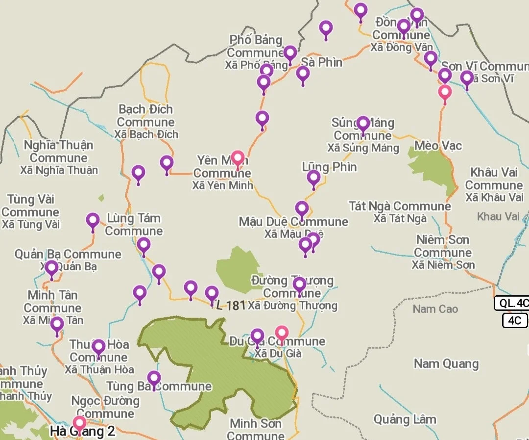
Understanding the Ha Giang Loop Map
At first glance, a Ha Giang Loop map looks like a tangle of noodles thrown at a mountain range. But once you understand the structure, it makes sense.
The classic loop flows roughly like this:
Ha Giang → Quan Ba → Yen Minh → Dong Van → Meo Vac → Du Gia → Ha Giang
From there, extensions branch east into Cao Bang, south toward Ba Be Lake, or quietly sideways into villages most people never hear about.
Your itinerary isn’t about ticking off places—it’s about how much time you give each road.
How to Read a Ha Giang Loop Map (For First-Timers)
No experience interpreting maps? No problem. We’ll break it down for you.
Where the Ha Giang Loop Starts and Ends
Start: Ha Giang City
Finish: Ha Giang City
It’s a loop, not a straight line—which means no backtracking.
Author’s Tip: Don’t forget your day bags in HG City thinking you’ll be returning to Bong Hostel Ha Giang every night!
Related article: Where Do I Store My Backpack Before the Ha Giang Loop? (Plus 18 Pre-Loop Planning Tips You Didn't Know You Needed).
Clockwise vs Anti-Clockwise Riding
Most Bong Hostel itineraries ride clockwise:
Better road positioning on mountain edges.
Safer visibility on tight passes.
Smoother traffic flow through Ma Pi Leng.
Why Google Maps Lies in Ha Giang
Google Maps doesn’t understand:
Livestock traffic.
Fog.
Landslides.
Road repairs.
Tea stops with locals.
Shortcuts and scenic side quests.
This is why itineraries matter more than maps alone.
Distance vs Riding Time
100 km in Ha Giang does not equal 100 km on a highway.
Expect:
Tight switchbacks.
Photo stops every 10 minutes.
Weather changes mid-pass.
A 90 km day can take 5–7 hours of riding. Always plan by time, not distance. This is why itineraries matter more than maps alone.
Related article: Rain or Shine: Your Guide to Ha Giang Loop Weather.
Ha Giang Loop Itinerary Comparison
Below is a comparative breakdown of the different Ha Giang Loop itineraries for 2026.
Route
Days
Distance
Best For
3D2N Classic
3
~350 km
Limited time & budget
4D3N Classic
4
~420 km
Best overall
Culture Tour
3–4
Variable
Culture lovers
Charity Tour
4
~420 km
Meaningful travel
Cao Bang Loop
5
~700 km
Adventure seekers
Cao Bang + Ba Be
7
900–1000 km
Ultimate journey
The Most Popular Ha Giang Loop Itineraries
Below are the most popular Ha Giang Loop itineraries. These are the ones that the average backpacker in your 18-bed dorm room on Koh Tao Island has done.
Classic Ha Giang Loop Itinerary: 3 Days 2 Nights
This is the most searched Ha Giang Loop itinerary, and for good reason.
Day 1: Ha Giang → Yen Minh (90 km)
Bac Sum Pass.
Quan Ba Heaven Gate.
Lung Tam hemp village.
Overnight in Yen Minh.
A gentle intro that still delivers serious views.
Day 2: Yen Minh → Meo Vac (110 km)
Tham Ma Pass.
Dong Van town.
Ma Pi Leng Pass.
Tu San Canyon viewpoints.
This is the day you gaze down upon the emerald ribbon of the Nho Que river.
Day 3: Meo Vac → Ha Giang (145 km)
Little Ma Pi Leng.
Mau Due valley.
Return to Bong Hostel by late afternoon.
Fast, efficient, unforgettable.

Classic Ha Giang Loop Itinerary: 4 Days 3 Nights (Best Choice)
If we had to recommend one Ha Giang Loop map and itinerary, this is it.
Why 4 Days is the Most Popular
Less riding fatigue.
Extra cultural time.
Du Gia village + waterfall.
Key Addition
Day 3: Meo Vac → Du Gia
Rice fields, river crossings, and a swim that resets your tired Happy Water-hungover soul.
At Bong Hostel, this is our most booked route, and for good reason.
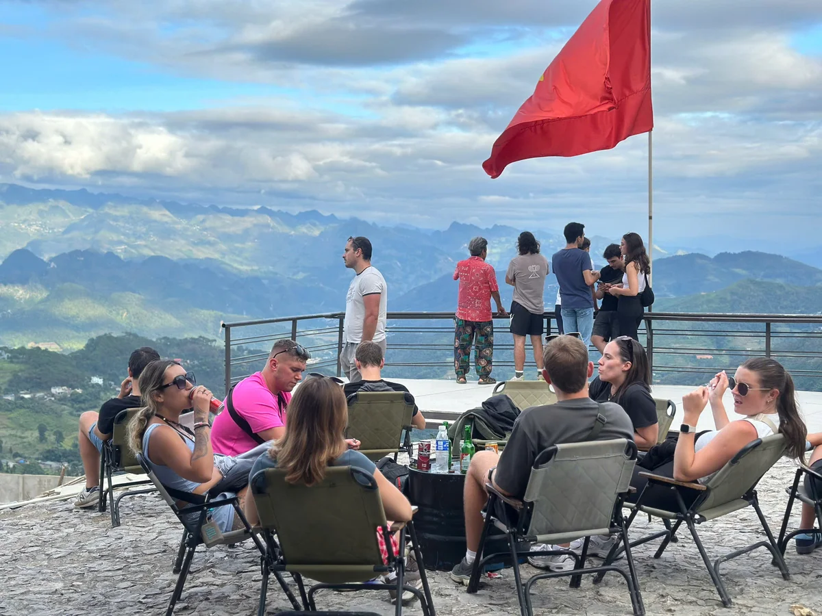
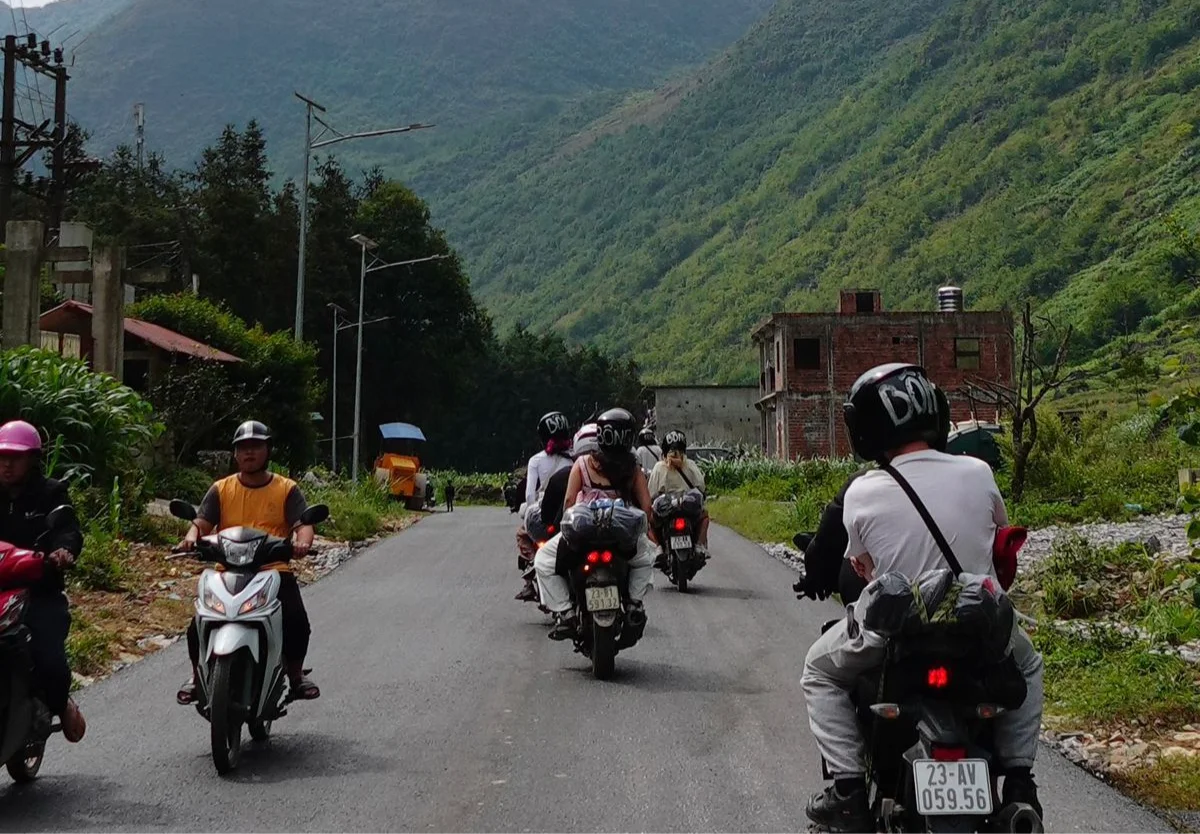
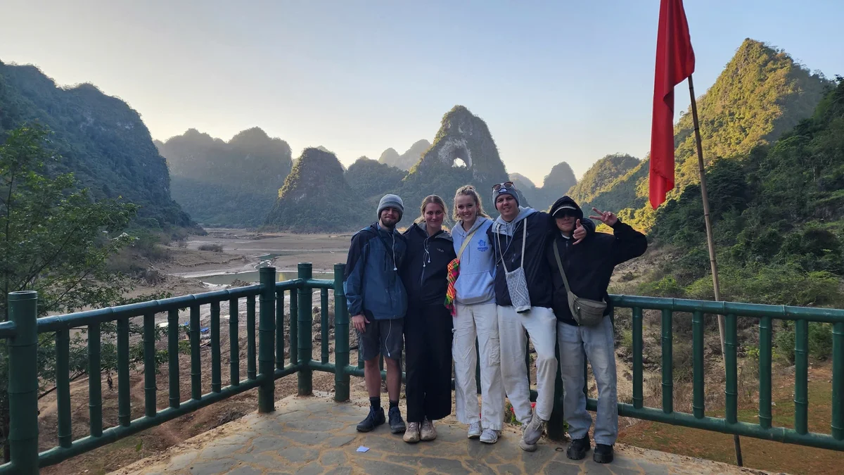
 Stops with Bong Hostel following the Classic 4-day 3-night Ha Giang Loop Map and Itinerary
Less Touristy Ha Giang Loop Routes & Itineraries (How to Avoid the Crowds in 2026)
As parts of the Ha Giang Loop became busier in 2025, more travelers began searching for less touristy Ha Giang Loop routes—not shortcuts, but smarter itineraries that avoid peak traffic and overcrowded stops.
In response, Bong Hostel rebuilt our Ha Giang Loop itineraries from the ground up, creating entirely new tours that follow different routes away from the busiest sections of the loop.
The result is a quieter, more meaningful Ha Giang Loop experience—designed for travelers who want more than just the classic ride.
Here’s how these new tours work.
1. Culture Tour: A Different Kind of Ha Giang Loop Map
The Bong Hostel Culture Tour follows the Loop—but goes inside it.
Instead of crowded viewpoints, you’ll:
Stay in Hmong villages like Lao Xa.
Walk through craft workshops.
Share meals with families, not tour groups.
At Bong Hostel, we designed this new itinerary in 2025 after travelers asked for less rush and more meaning.
Related article: Ha Giang Loop Culture Tour: Bong Hostel’s New Route Guide.
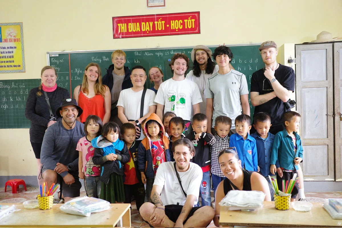
2. Charity Tour: Same Loop, Bigger Impact
Although the Ha Giang Loop Charity Tour has already run successfully, we plan to continue these tours in the future as part of our long-term community work.
What Makes It Different
Day 2 becomes a full school visit.
No traveler donations required.
Fully funded by Bong Hostel.
Travelers help with:
Games and simple English lessons.
Cooking meals.
Distributing supplies to local children.
It’s still a Loop adventure—just with a lot more heart.
3. The Secret Tour: For People Who Trust the Process
We can’t give you a full Ha Giang Loop map for the Bong Hostel Secret Tour—because that defeats the point.
What we can say:
You’ll ride beyond the usual Loop.
You’ll enter Cao Bang in unexpected ways.
You’ll visit villages that don’t appear on Google Maps.
You’ll have two tour guides.
You’ll have an Easy Rider/new best friend built in.
Expect waterfalls, caves, lakes, karaoke, mystery lunches, and that slightly suspicious feeling that you’re somewhere special.
Spoiler: you are.
Related article: The Ha Giang Loop and Beyond: What is the Bong Hostel Secret Tour?
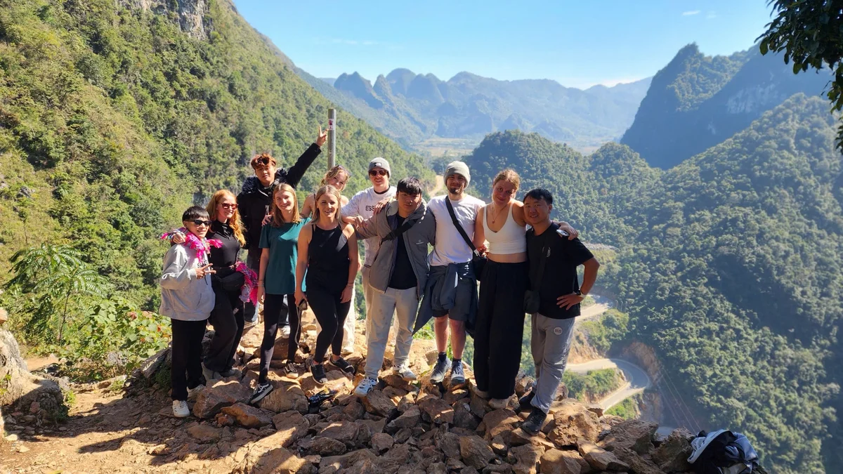
 Bong Hostel has rebuilt their Ha Giang Loop itineraries from the ground up, creating entirely new tours for 2026
Cao Bang Loop Extensions: Going Beyond the Classic Map
Speaking of Cao Bang, why not extend your classic Ha Giang Loop tour onto the Cao Bang Loop with Bong Hostel?
Cao Bang Loop: 5 Days 4 Nights Itinerary
This route extends east into Cao Bang Province, adding:
Ban Gioc Waterfall (one of the world’s largest cross-border waterfalls).
Remote mountain towns like Bao Lac.
Fewer travellers, bigger landscapes.
If you want something wilder but manageable then this is the extended Ha Giang Loop itinerary for you.
Cao Bang + Ba Be Lake: 7 Days 6 Nights Itinerary
The ultimate Ha Giang Loop map and itinerary.
Covering 900–1,000 km, this route links:
The Ha Giang Loop.
Ban Gioc Waterfall.
Nguom Ngao Cave.
Ba Be Lake—the largest natural freshwater lake in Vietnam.
Expect:
Epic passes like Khau Coc Cha.
Boat rides through massive canyons.
Limestone caves, jungle lakes, and total digital detox.
Many travelers call this their favorite experience in Southeast Asia. We’re not arguing.
 Extend your Ha Giang Loop itinerary to include Cao Bang in 2026
Ha Giang Loop Map and Itinerary FAQs for 2026
Q. How many days do you need for the Ha Giang Loop?
A. Minimum: 3 days. Ideal: 4 days. Best overall experience: 5–7 days with extensions.
Four days gives you the perfect balance of scenery, rest, and culture.
Q. Is the Ha Giang Loop too touristy in 2026?
A. Some viewpoints are busy—but most of the Loop is still quiet.
Choosing the right itinerary matters more than timing. Culture, charity, and Cao Bang routes avoid crowds naturally.
Q. Is a map enough, or is a guide better?
A. A map shows roads. A guide shows stories and the real culture of Ha Giang.
Our easy riders are from these villages. They know when roads change, where to stop, and how to keep you safe.
Q. Can beginners ride the Ha Giang Loop?
A. It depends on several factors, including your riding confidence, previous motorbike experience, and the time of year.
Road conditions can change quickly—especially during the rainy season—making the Ha Giang Loop more challenging for riders of all levels.
At Bong Hostel, safety always comes first, which is why we usually recommend an easy rider for beginners.
That said, confident riders with the correct licence can join a guided group tour, where experienced guides set the pace, monitor conditions, and provide support along the way.
The roads are demanding, but with the right guidance, they’re manageable for beginner riders who know their limits.
Q. Is Google Maps reliable in Ha Giang?
A. Short answer: no.
It’s useful for orientation, not timing. It doesn’t know the cool backroads that lead to the best views of your life.
And honestly? It’s just a lot easier to book a guided tour with Bong Hostel and let us worry about navigation.
For our full Ha Giang Loop FAQs breakdown, click here: Ha Giang Loop FAQs: 65+ Questions Backpackers Ask Before Doing the Loop (A–Z Guide: Part 1).
Final Thoughts: Choosing the Right Ha Giang Loop Map and Itinerary
If you want:
Best overall experience: 4 Days 3 Nights
Limited time: 3 Days 2 Nights
Cultural depth: Culture Tour
Meaningful travel: Charity Tour
Cao Bang Loop: 5 Days 4 Nights
Once-in-a-lifetime adventure: Cao Bang 7 Days / The Secret Tour
At Bong Hostel, we don’t just sell tours—we ride these routes daily, adjust them seasonally, and refine them based on real experiences.
If you’re ready to explore the Ha Giang Loop map and itinerary that actually fits your travel style, you can explore our tours, ask questions, or book directly with our team here:
Best Hà Giang Loop Company | Bong Hostel Hà Giang.
Same mountains. Better route.
Don’t just dream about it—make it happen with Bong Hostel.
About Faye Hilling
Travel writer and Vietnam explorer sharing authentic experiences and insider tips for discovering the beauty of Vietnam.